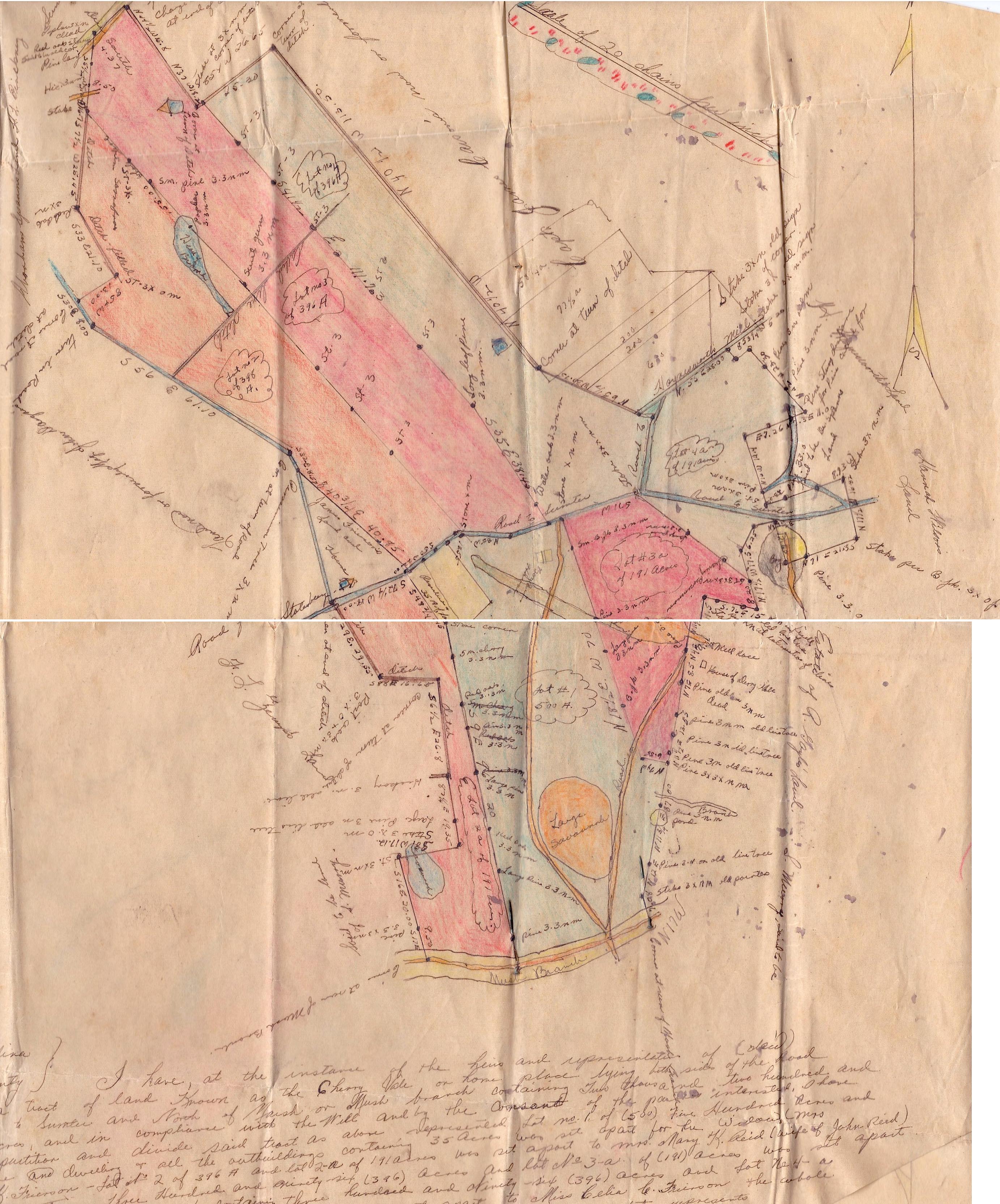
 At right is a plat of Cherry Vale plantation and lands from a survey done after the death of John Napolean Frierson (b. 2/21/1818, d. 2/19/1887). He was survived by his wife and 5 living children. The bottom of the plat is signed by James D. McSwain, Deputy Surveyor of Sumter County, and dated May 27, 1887, and states: “ I have, at the instance of the heirs and representatives of (?) have resurveyed a tract of land known as the Cherry Vale or home place lying on both sides of the road from Stateburg to Sumter and North of Marsh or Mush branch, containing two thousand two hundred and ninety-six acres, and in compliance with the Will and by the consent of the parties interested, I have proceeded to partition and divide said tract as above represented. Lot no. 1 of (500) five hundred acres and the enclosure and dwelling and all the outbuildings containing 35 acres was set apart for the widow Mrs. Catherine K. Frierson – lot no 2. of 396 A and lot 2-a of 191 acres was set apart to Mrs. Mary K. Reid (wife of John Reid). And lot no 3 containing three hundred and ninety-six (396) acres and lot no 3-a of 191 acres was set apart to James J. Frierson and lot no 4 containing three hundred and ninety-six (396) acres and lot no.4-a containing one hundred and ninety-six acres was set apart to Miss Celia (sic) C. Frierson the whole tract and division having such shape form and marks as the above plat represents. Surveyed the 27th day of May 1887 by James D. McSwain, Dpy Sur. Recorded in Deed Book AAA-112, Recorded 20 Sept. 1887, J.D. Gosham, R. Mc” . James Julian Frierson (b. 6/9/1849, d. 2/16/1890) was my great-grandfather and the middle son of Napolean. He would live only 3 years from the time of his father’s death – alcohol it was said hastened his demise!
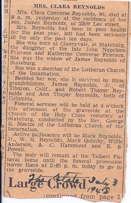 Surveyor McSwain mistakenly refers to Napolean’s youngest daughter as Celia – her full name was Clara Converse Frierson (b. 6/20/1864, d. 7/2/1948) and she married James Reynolds in 1888.
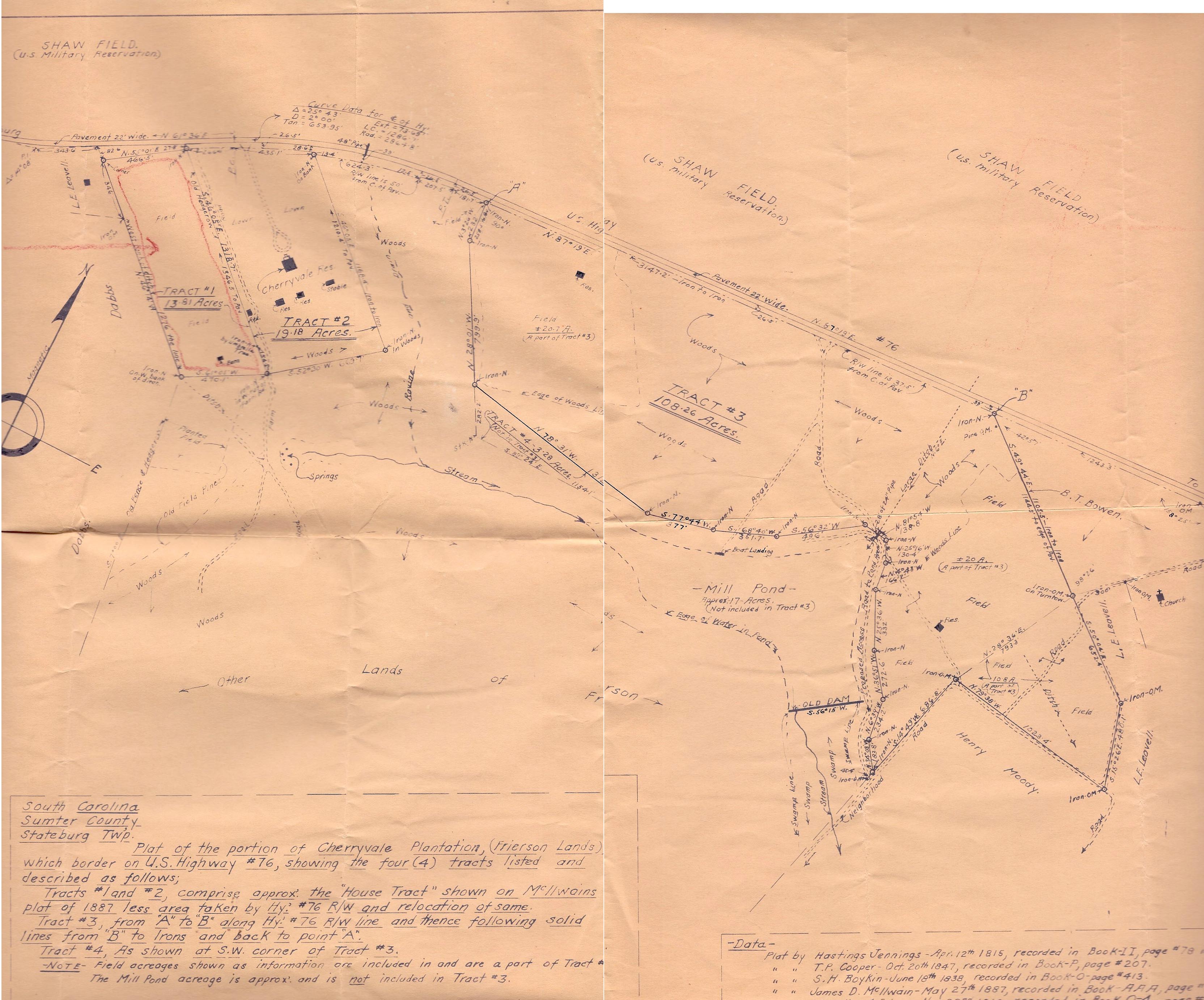
A plat of Cherry Vale in 1949, shows a much smaller piece of property, basically just Lot #1 from the 1887 version. This plat was done to prepare for the sale of Cherry Vale. Note how much of the original plantation was at this time occupied by Shaw Field, north of the Stateburg to Sumter Road (U.S. Highway #76). Be careful in your comparisons though – the first plat has a scale of 1 inch = 20 chains (1 inch = 1320 feet ), while the second plat has a scale of 1 inch = 400 feet.